This was my third attempt at conquering Kohoj I was unsuccessful in the past as we had got lost on the hills, due to no proper directions.
 |
| Kohoj Fort |
On the day I was visiting Durgadi Fort, I decided to ask Manohar, Dominic and Nayan if they were free to accompany me to Kohoj fort.
Nayan had plans so it was just the three of us here.
 |
| Reflection of Kohoj Fort in the waters |
Now I had not informed Manohar and Dominic that I had tried climbing this fort, twice earlier but had failed.
 |
| Arrow signs on the rocks |
We decided to meet on the Western Express Highway. At the intersection of the Metro line, Jog Flyover and the Highway. The same place we met while we traveled to Jawahar. We were traveling in the car.
 |
| Manohar, Dominic and Me |
We met at 7:45 AM and headed off on the highway to see Kohoj Fort. As it was early in the morning there was not much traffic on the road. P.S. after Virar there is a bottle neck due to road maintenance.
 |
| Sheep |
The Western Express Highway aka NH8. We braked for breakfast at Hotel Kamat's. As said by Manohar many a times on treks, a good breakfast is always necessary while on treks and we did just that.
 |
| Shoe soles |
There are three toll naka's on the way.
We then headed off the Manor Wada Road to reach village Vaghote. The base village to Kohoj Fort. Please refer to google maps for navigation. It is accurate. We were at the base at 10:05 AM.
 |
| Dominic with snake skin |
Picked up our bagpacks and we headed off to conquer Kohoj.
Now there are signs in the form of arrows on the rocks, so that you don't get lost. This time we decided to follow the signs, unlike last time when we got lost up the hills.
 |
| Ants mating |
If you follow the signs, you will first cross, a water body cut in the rock, fields and later the heart shaped dam.
If unsure then ask the villagers around, they too will guide you. Near the dam we were not able to locate the signs so we asked a Shepard and she guided us. Her dialect was a bit difficult to understand but we still managed to be on the right track.
 |
| Temple |
Once you cross the dam section, the trek starts, now there are proper signs placed on rocks, that one does not get lost. A big Thank You to the trekking group who has done this.
We followed the signs and in a matter of 2 1/2 hours we were atop the fort. Now remember the climb is a bit difficult. The path is full of loose soil, and stones and rocks. It is a rollercoaster ride up and down the hill. Now we were not climbing Kohoj, but the hills before it to reach Kohoj. The topmost stretch is very steep and to top it, has loose soil. So be careful.
 |
| Graffiti on the walls of a tank cutout from rock |
Nothing much to see atop the fort. It has a couple of temples here. Now the fortification was missing. How can it be called a fort with no fortification. I asked myself.
 |
| Ideal spot for camping atop Kohoj Fort |
We had lunch in the form of sandwiches, cakes, thepla and then proceeded to climb the highest point of the fort.
 |
| On our way to the topmost point of the fort |
Not much is known about the history of this fort.
Now we were not alone on the fort, there were villagers too who were there to celebrate. They had bought along with them live chicken, rice and masalas and utensils to prepare lunch. Plus they got beer too. How can they drink hot beer? I asked myself. Strange
 |
| That's Me |
Finally on the topmost point of the fort we saw the fortification. The walls, but just a small part of it. I believe the rest of it might have collapsed over the years. This is all that remains of it.
 |
| Fortification |
Took a couple of videos along with photos atop the fort. Now this as the tallest point amongst the hill ranges around. I was happy about the fact that I as on the tallest point and that like the previous two attempts I didn't get lost on the hills.
 |
| Another Temple |
Took a couple of lessons in regards to ascending and descending hills from Manohar, which would benefit me in the long run.
There are a couple of water bodies, cut in the rock which are used to store water. As we stopped to fuel our water bottles we noticed the villagers taking beer bottles out of the water. It then occured to us that the beer bottles were getting chilled in the cold water. Aha now it makes sense to drink beer on the hilltop.
 |
| Highest point on the fort |
We also saw them cooking up the hill.
There were a couple of them who had come there to hunt for rabbits. They had laid nets all over the place for them. I couldn't locate any rabbits up the hill.
 |
| Manohar and me with our sticks |
We then decided to descend the hill. The time was around 03:45 PM on my watch. As we are still in the winter season nightfall happens around 05:30 PM. So we had to be down before that and to top it we could not afford to get lost.
 |
| Another reflection of Kohoj fort in the waters |
As I mentioned the initial stretch is difficult as it is a 75 degree climb over loose soil, so it took time to descend, then as I mentioned it was a roller coaster ride downhill.
 |
| Manohar, Dominic and Me at the topmost point of the fort |
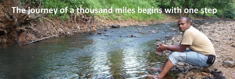
Finally at 05:10 PM we were near the heart shaped lake. Refreshed ourselves in the waters and then headed off to the car to head back home. We kickstarted our journey at 06:40 PM to reach our start point at Andheri at 09:10 PM. It took us time due to the bottlenecks and traffic around.
 |
| Heart Shaped Lake |
The good thing about this trek, is that after two failed attempts, I was finally able to conquer it. Sadly nothing much remains atop the fort, a few temples, water tanks and fortification. The second good thing is , it is the highest point in that hill range and so offers a very good view of the hills, valleys, farms, houses and roads below. Maybe was not a fort but a watchtower to watch over the land below.


0 comments:
Post a Comment